
 Disclosure: RIDE Adventures is a participant in the Amazon Services LLC Associates Program as well as other affiliate programs, designed to provide a means for us to earn fees by linking to Amazon and affiliated sites at no extra cost to you. Please see our Disclosure for more details.
Getting lost is half the fun, but at some point, you need to get where you're going. These are the off-road GPS units we trust on our motorcycles and 4x4s.
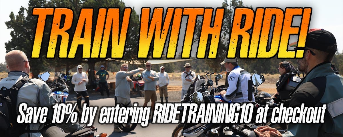
Every year, we spent untold hours scouting out routes for our tours. Sometimes that's a completely new tour in a completely new country, other times we're updating a route we've been running for years to keep it new and exciting.
This year, we've been doing just that in Mongolia. Keep an eye out for that tour, by the way, because it's gonna be an absolute riot.
 "A few friends we met in Mongolia this month. Stay tuned for more..."
With that being said, in our experience, we rarely scout a new route of any kind without two crucial components: a local guide and a reliable off-road GPS for backup.
We've used a dozen or so different makes and models of off-road GPS over the years. Some of them have been motorcycle-specific, while others have been traditional handhelds we've repurposed for off-roading and adventure touring.

Knowing what we know now, we can confidently say that the former is what you want if no-fuss navigation is what you're after. The tech has come a long way, and the benefits for motorcyclists can't be overstated.
That being said, the number of serious options for two-wheeled navigation has dropped considerably. In fact, there are only four options we'd even consider recommending, so here's a rundown of the best off-road GPS options and our feedback on each.
Quick List for the Best Motorcycle GPS Units:
| Off-Road GPS Unit: | Summary: | Price: |
|
Garmin Zumo XT2 Motorcycle GPS
|
The best off-road GPS on the market for motorcyclists, full stop. | CHECK PRICE |
|
Trail Tech Voyager Pro GPS
|
All-in-one GPS, speedometer, and tach that's ideal for dual sport and enduro minimalists. | CHECK PRICE |
|
Garmin Tread 2 Powersport GPS
|
Do-it-all powersports GPS that trades moto-specific features for added versatility. | CHECK PRICE |
|
Garmin Montana 710/710i
|
A general-purpose handheld GPS that doubles as a solid navigator and two-way messenger. | CHECK PRICE |


A Word on Off-Road GPS vs. Navigation...
 "Trust us: your smartphone app doesn't work out here."
One of the biggest mistakes people make when shopping for an off-road GPS (or any GPS, for that matter) is getting navigation systems and GPS units confused. The difference? One of them reliably works offline, the other doesn't.
This is one of the reasons why Garmin devices cost a small fortune while knock-offs are a third of the price. True GPS units like a Garmin Xumo XT2 leverage GPS sensors and standalone satellite networks that work independently of cellular service.
This is why Garmin inReach systems are still able to send messages in the most remote spots on the globe. It's also why their GPS systems are able to change course or redirect under the same conditions, while your iPhone just searches for a signal.
True, your iPhone does include built-in GPS functionality. However, your phone's integrated GPS antenna pales in comparison to a standalone GPS unit. This is why every offshore boat on the planet uses a standalone GPS antenna, for instance.
 "Road closures due to weather are common in Baja. Guessing your way back to an alternate route is ill-advised."
Inexpensive alternatives (we won't name any brands, but you'll find them all on Amazon) are typically just glorified Android devices, allowing you to download maps for use offline like any smartphone, but are still subject to the same dead zones.
These units do serve a purpose (if you want Apple CarPlay or aftermarket TPMS monitoring on your bike, for instance), but we would never recommend them for reliable off-grid navigation.
The Best Off-Road GPS Units For Adventure
Keeping the above in mind, there are only four units we'd currently recommend in good faith. That's not to say there aren't other options out there, mind you, but these are the ones we believe are worth considering investing in.
Garmin Zumo XT2 GPS
The Garmin Zumo XT2 is hands down the best off-road GPS for motorcycle riders that money can buy at the moment. There's really no debate, and we'd guess about 95% of readers can stop their search here.
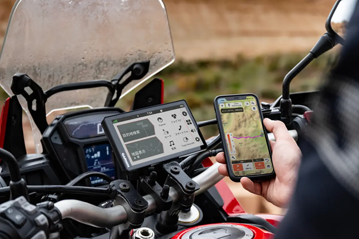 "The Zumo XT2 is tailor-made for motorcycles, and adds smartphone/headset connectivity to any bike as well." photo: Garmin
The Zumo XT2 is Garmin's motorcycle-specific GPS offering, and it's about as close to flawless as they come. We've been using this bad boy since it first launched, and it's got all the features riders of all kinds could ever want.
The Zumo XT2 works great as both a pavement and off-road GPS navigator, and even allows you to select "adventurous" routes with more curves, challenges, and views. It also includes a database of recommended moto-specific routes from their rider community.

The six-inch touchscreen is glove-friendly and super bright, the unit holds up to constant dust and water without issue, the track recording feature is easy to use, and Garmin's "Tread" app makes DIY route planning simple and intuitive with a little practice.
The only downside for us is the cost, as one of these bad boys will set you back a cool $600. We'll also note that native storage is limited to 32GB (about 400 square miles of maps), so you'll likely want to buy a larger microSD card upgrade as well.

PROS |
CONS |
|
|
Trail Tech Voyager Pro GPS Kit
Trail Tech's Voyager Pro is the only off-road GPS option we'd recommend that isn't a Garmin. This one makes our list as an attractive option for dual-sport and enduro riders because it also functions as a dash upgrade for simpler bikes.
The Voyager Pro covers the basics with GPX file compatibility and track recording, but isn't a turn-by-turn navigator. That means you can see your route and where you're at, but it won't tell you if you miss a turn, or how far you are from your next intersection.
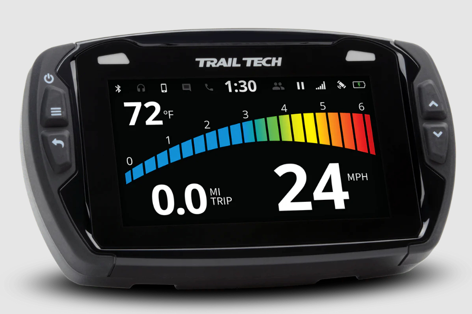 "The Voyager Pro system adds a ton of info to your dash, and also integrates with your smartphone for music, calls, etc."
With that being said, the Voyager's main redeeming quality is that Trail Tech offers a sensor kit that transforms the unit into a multi-functional dash. The Voyager Pro can be set up to display RPM, engine temp, battery voltage, and even an odometer.

That info is great to have on basic dual sport or enduro models, but isn't worth the spend on more sophisticated machines. This off-road GPS is also more expensive than a Zumo XT2, and that's before you add in Trail Tech's optional sensor kit.

PROS |
CONS |
|
|
Garmin Tread 2 Powersports GPS Navigator
The Tread 2 is Garmin's take on a more "general use" off-road GPS. Functionally, it's more or less identical to the Zumo XT2, but it trades the Zumo's laser focus on motorcycle-specific features for a broader offering of recreational off-road navigation.
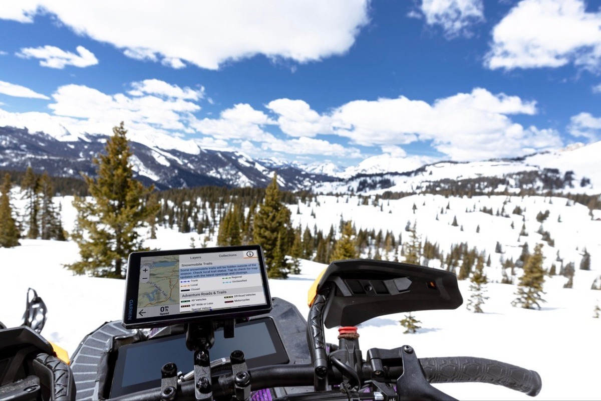 "Garmin's Tread 2 is designed to work with all your toys: bikes, quads, snowmobiles, and whatever else you're into." photo: Garmin
We're including this one in the roundup for folks who partake in other internal combustion hobbies in the off-season. If you've got snowmobiles, side-by-sides, or an overlanding rig in the garage, this one swaps between toys pretty seamlessly.
The Tread 2 also offers a few niche features for existing users of the Garmin ecosystem including dog tracking for GPS collars and compatibility with Outdoor+ mapping users.
With that being said, the Tread 2 typically costs about $100 more than the Zumo XT2, so if you're not going to get any value out of the multi-discipline versatility, you're better off sticking to our top pick.

PROS |
CONS |
|
|
Garmin Montana 710/710i
Last but not least, if you absolutely, positively just prefer a handheld-style GPS, you can absolutely, positively make due with the Garmin Montana 710 series. Hard-nosed navigators can get by with less, but this is the least specialized rig we'd recommend.
We dig the Montana 710 because it's set up for turn-by-turn navigation, but also functions with off-road/topographic map routing, no pavement necessary. It's also compatible with Garmin's subscription-based Outdoor Maps+ offering.
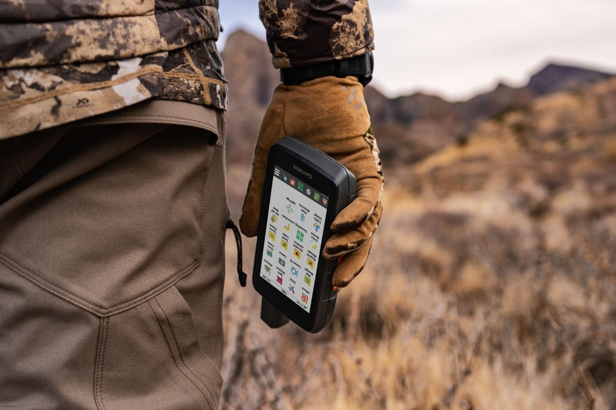 "The Montana 710i ain't cheap, but it's a true all-purpose handheld navigation solution for any off-grid activity." photo: Garmin
You've got two options here: the standard Montana 710, and the 710i. Stepping up to the 710i package adds Garmin's popular inReach technology to the mix, removing the need to carry a standalone inReach SOS system or two-way messenger.
Drawbacks here include a smaller 5" screen that's more difficult to navigate, a higher $650 starting price, and a lack of motorcycle-specific features. Outdoorsmen will find value in the Montana's versatility, but it's probably overkill for everyone else.

PROS |
CONS |
|
|
CHECK PRICE:
AMAZON
Hope this article was helpful and got you the best off-road GPS for your next adventure! If you want more articles like this to arrive straight to your inbox, subscribe here.
→Read More:
Are smartphones these days the only GPS unit you need?
Best Lightweight Adventure bikes on the Market today